Overview
Sigiriya in one paragraph
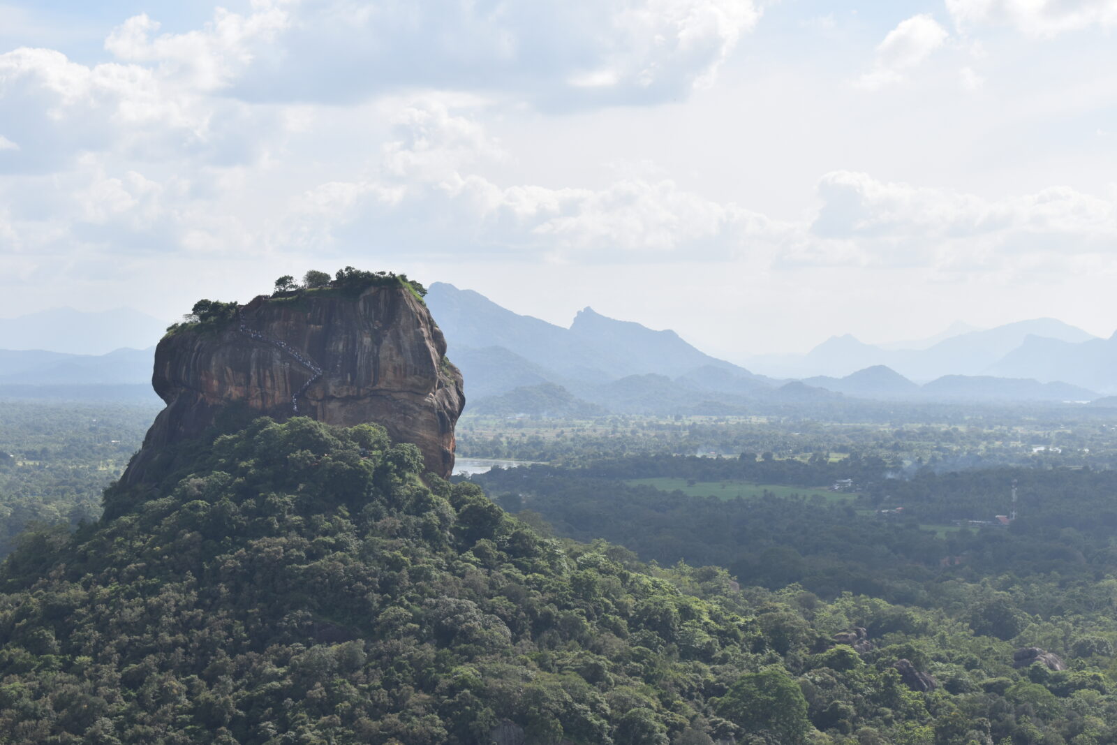
King Kashyapa built his capital on top of a rock in 477 AD and abandoned it eighteen years later. What remains is the most complete surviving example of first-millennium urban planning in Asia: water gardens fed by hydraulics that still work in the monsoon, boulder gardens, a mirror wall polished enough to reflect, and twenty-one surviving frescoes of court women painted in a rock pocket 100 metres up. Most visitors climb, look and leave in two hours. Give it half a day and add Pidurangala opposite for the view back.
Top attractions
What to see
- Sigiriya Rock Fortress and the Lion Staircase
- The frescoes and the mirror wall
- The royal water gardens at the base
- Pidurangala Rock, facing Sigiriya
- Sigiriya Museum
- Hurulu Eco Park and Minneriya nearby
Things to do
How we would spend a day here
- Climb at 7am opening to beat both heat and crowds
- Watch sunset from Pidurangala, looking at Sigiriya
- Take a bullock cart and catamaran village tour at Habarana
- Jeep safari at Minneriya, Kaudulla or Hurulu
- Cycle the paddy tracks and irrigation tanks at dawn
Best time to visit
Any month. December to April is driest; the rock is climbable year round but avoid midday heat from March to May.
Nearby
- Dambulla, 20 minutes
- Polonnaruwa, 1 hour
- Minneriya, 40 minutes
- Anuradhapura, 1 hour 45
Gallery
FAQ
Sigiriya — your questions
How long does the climb take?
Sixty to ninety minutes up for most people, thirty to forty down. There are shaded landings roughly every 300 steps.
Is there an alternative if we cannot climb?
Pidurangala is shorter but rougher underfoot. The water gardens and museum at the base are worth a visit on their own, and Dambulla cave temple is twenty minutes away.
What does entry cost?
Around USD 36 per adult for foreign visitors, payable at the ticket office. Your guide will queue for you.